(no subject)
Jun. 1st, 2026 10:56 pmQuick note that post-by-email and comment-by-email is (sometimes?) failing silently without actually posting right now! I'm pretty sure this is related to last night's shenanigans and will be fixed once Mark can finish the full fix for it, which he's working on, but if you've posted or replied by email in the last 24 hours, fish it out of your sent folder to check if it posted!
EDIT: This should be fixed as of around 7AM EDT! We *believe* everything that was stuck in the plumbing has been sent along to your journal or the comment thread it was meant for; it's definitely not where it was stuck anymore, at least.
EDIT: This should be fixed as of around 7AM EDT! We *believe* everything that was stuck in the plumbing has been sent along to your journal or the comment thread it was meant for; it's definitely not where it was stuck anymore, at least.
Saved comments during May 2026
Jun. 1st, 2026 09:42 pmMy comments on Party of two defeats The First in SWTOR.
A big, ugly, MEAN puppy! Now I can't get that image out of my head.
It wouldn't surprise me if the devs used a puppy playing rough as a model or for motion capture.
My comment on 'Last Week Tonight' asks 'Ayn Rand - How Is This Still A Thing?' for Throwback Thursday.
Thanks to Steve in Manhattan for linking to this entry at Mike's Blog Roundup on Crooks and Liars and welcome to his readers who came here from that link. Also, welcome to my international readers from Brazil, Iraq, Bangladesh, Germany, Chile, Argentina, Pakistan, Singapore, France, India, China, Mexico, Spain, Columbia, Venezuela, Canada, Türkiye, the Philippines, Saudi Arabia, and the rest of the planet. Looks like you're checking in on the mood here in the U.S. May my blog be the right place for you!
My comment on We Caught Elon Musk’s AI Company Defying Federal Law.
Watch "We Saw What AI Data Centers Don't Want You to See" on PBS Terra. I think it counts as one.
🚘 Headlines About California Highways – May 2026
Jun. 1st, 2026 07:10 pm And with the flipping of the page, the Lusty Month of May is over. What lusty thing did you do in May? Me, I went to St. Louis. But more on that later. We’re also near the end of the primary political season here in California. If you want to see my deep-dive ballot analysis and recommendations, you can find the posts here. Feel free to disagree with me and to comment on the posts, but note I’ve already cast my ballot. You might convince someone else, tho…
Going back to St. Louis. During the election season, I’ve seen loads of folks (especially on Nextdoor) complaining about the conditions of our city streets here in Los Angeles. Having driven in St. Louis for a week, we have it great in Los Angeles. Trotting down Gravois or Market or Grand or other streets within the city, we were rattling so much I thought I would lose a filling. No city is perfect, but LA streets are great compared to places that have freeze cycles.
![]() Turning to the California Highways: Route by Route podcast: Tom and I are finishing up recording Season 4 (we have 2 episodes yet to record), and are planning the inter-season bonus episodes. I particularly like ep 4.12, which covers the unbuilt freeways of the San Fernando Valley, using the first segment of Route 14 as the starting point. I’m continuing the research for Season 5, which in may has meant looking into US 91, US 95, Sign Route 195, and some digressions into US 399 and US 466. Zencaster is working well for recording the podcast, although Tom had some microphone trouble in the last episode. As a reminder: You can help our listening audience grow. Please tell your friends about the podcast, “like”, “
Turning to the California Highways: Route by Route podcast: Tom and I are finishing up recording Season 4 (we have 2 episodes yet to record), and are planning the inter-season bonus episodes. I particularly like ep 4.12, which covers the unbuilt freeways of the San Fernando Valley, using the first segment of Route 14 as the starting point. I’m continuing the research for Season 5, which in may has meant looking into US 91, US 95, Sign Route 195, and some digressions into US 399 and US 466. Zencaster is working well for recording the podcast, although Tom had some microphone trouble in the last episode. As a reminder: You can help our listening audience grow. Please tell your friends about the podcast, “like”, “ ”, or “favorite” it, and give it a rating in your favorite podcatcher. Share the podcast on Facebook groups, and in your Bluesky and Mastodon communities. For those that hear the early episodes, the sound quality of the episodes does get better — we were learning. If you know sound editing, feel free to give me advice (I use Audacity to edit). As always, you can keep up with the show at the podcast’s forever home at https://www.caroutebyroute.org , the show’s page on Spotify for Creators, or you can subscribe through your favorite podcatching app or via the RSS feeds (CARxR, Spotify for Creators) . The following episodes have been posted this month:
- May | CA RxR 4.11: Route 13: Oakland and Berkeley. With Episode 4.11, our attention turns to Route 13. In this episode, we look at LRN 13, Sign Route 13, and Route 13. LRN 13 was the Sonora and Mono Wagon Road, which became today’s Route 219 and Route 108. Sign Route 13 was short-lived, quickly being renumbered as Sign Route 17 and Route 17, and is today’s Route 17, I-880, and I-580 N of the Bay Bridge. The post-1964 Route 13 of today runs from Route 61 to Route 61 through Oakland and Berkeley, and is best known as the Warren Freeway and Ashby Blvd. As for Route 61, you’ll just have to listen to the episode. Next time: In Ep 4.12, we’ll look at Route 14 and the unbuilt freeways of the San Fernando Valley. Lastly, note that in this episode Tom was having microphone trouble, so his sound is a bit off (and I don’t know Audacity well enough to fix it). (Spotify for Creators)
As a reminder: One of the sources for the highway page updates (and the raison d’etre for for this post) are headlines about California Highways that I’ve seen over the last month. I collect them in this post, which serves as fodder for the updates to my California Highways site, and so there are also other pages and things I’ve seen that I wanted to remember for the site updates. Lastly, the post also includes some things that I think would be of peripheral interest to my highway-obsessed highway-interested readers.
Well, you should now be up to date. Here are the headlines that I found about California’s highways for May 2026, which was a pretty light much for highway headlines of interest.
Key
[Ħ Historical information | $ Paywalls, $$ really obnoxious paywalls, and ∅ other annoying restrictions. I’m no longer going to list the paper names, as I’m including them in the headlines now. Note: For $ paywalls, sometimes the only way is incognito mode, grabbing the text before the paywall shows, and pasting into an editor. See this article for more tips on bypassing paywalls. $$ paywalls require the use of archive.ph. ☊ indicates an primarily audio article.  indicates a primarily video article.
  indicates hat/tip to someone for finding this article. ]
Highway Headlines
- State Route 41 Expressway Project (FB/Caltrans District 6). Caltrans was honored to be part of Madera County’s official groundbreaking ceremony today on their new State Route 41 Expressway Project! The project will widen State Route 41, in both directions, from a two-lane highway to a four-lane expressway. The project is scheduled to be completed in May of 2028
- $ Highway 101 offramp closure planned in San Rafael (Marin I-J). The northbound Highway 101 offramp onto Manuel T. Freitas Parkway in San Rafael will be closed from 11 p.m. Monday through 5 a.m. Friday. The closure will allow Caltrans to perform drainage improvements related to the construction of an $11.5 million traffic roundabout at the intersection of Freitas Parkway at Civic Center Drive and Redwood Highway on the east side of the highway. The intersection, which closed in February, will remain closed through June for construction. The project is expected to be completed this fall.
- Embarcadero road improvements in Palo Alto scheduled for summer (San José Spotlight). Amid concerns about traffic congestion and emergency response times, one glaring issue that could arise if Palo Alto leaders decide to close the Churchill Avenue train crossing is the lack of an adequate detour for cyclists and pedestrians. For Palo Alto High School students trying to get to class, their most likely route would follow Embarcadero Road to get on the other side of the Caltrain tracks. But as students and residents have testified, walking or biking along the street feels dangerous due to the lack of pedestrian infrastructure and the speed of passing vehicles. Some residents have suggested that closing Churchill in an attempt to prevent youth suicides could have the unintended effect of causing injury or death to rerouted high schoolers attempting to traverse Embarcadero on the way to school.
- Half Moon Bay to host workshops on Highway 1 traffic, safety (Local News Matters). Half Moon Bay city officials are inviting residents to share feedback on traffic and safety concerns along Highway 1 during a series of community workshops this week. The city will host a public “Discovery Workshop” and multiple open studio sessions to gather input on daily travel experiences and potential improvements to the highway corridor, according to city officials. An in-person workshop is scheduled for May 6 from 5 to 7 p.m. at the Half Moon Bay Library, along with a drop-in session earlier that day from 3 to 7 p.m. at the same location. Additional open studio sessions will be held May 7 and May 8 at the city’s Emergency Operations Center.
- $3M secured for ‘deck park’ over Interstate 5 in downtown Sacramento. How much more is needed? (Fox 40 Sacramento). More than $3 million in federal funding has been secured to help kickstart a long-discussed project aimed at reconnecting downtown Sacramento with the riverfront. But is it enough? The $3.15 million in funding would support planning for a proposed “deck park” over Interstate 5 between Capitol Mall and O Street, near the Crocker Art Museum. City leaders said the project would help address the divide created when Interstate 5 was built through Sacramento, separating downtown from the riverfront and displacing what was once part of the city’s Japantown.
- How this new ‘crisscross’ interchange will improve Vallejo traffic (KTVU FOX 2). More than $3 million in federal funding has been secured to help kickstart a long-discussed project aimed at reconnecting downtown Sacramento with the riverfront. But is it enough? The $3.15 million in funding would support planning for a proposed “deck park” over Interstate 5 between Capitol Mall and O Street, near the Crocker Art Museum. City leaders said the project would help address the divide created when Interstate 5 was built through Sacramento, separating downtown from the riverfront and displacing what was once part of the city’s Japantown.
- Indianola Interchange Open by May 29 (FB/Caltrans District 1). NEW U.S. 101 INTERCHANGE AT INDIANOLA EXPECTED TO FULLY OPEN BY MAY 29: A major safety upgrade along Humboldt County’s most traveled stretch of roadway between Eureka and Arcata is expected to fully open by May 29. U.S. 101 traffic is already using the new elevated alignment at Indianola, with northbound access available. But by May 29, the full interchange is expected to open, including southbound access beneath the highway.
- Crossover In Effect Along Westbound Interstate 80 Near Yuba Gap (Caltrans). Caltrans is reminding motorists the traffic shift along westbound Interstate 80 (I-80) near the junction with State Route 20 (SR 20) is now in effect, as part of the $112 million Yuba Pass Separation Overhead Bridge Project. About 2 miles west of Eagle Lakes Road, motorists will use the two left lanes and veer left to utilize the crossover and remain on westbound I-80. Motorists will cross back over to the westbound side of the highway just past the exit to Yuba Gap. Motorists exiting westbound I-80 to State Route 20 will use the far-right lane and veer to the right to access the off-ramp.
- SR-20 closure underway this week at I-80 junction, more May shutdowns ahead (ABC 10 Sacramento). Drivers in the Sierra are already seeing impacts this week as Caltrans begins a series of State Route 20 closures tied to a major bridge project at Interstate 80. Eastbound SR-20 at the I-80 junction is closing in phases throughout May while crews demolish part of an overcrossing as part of the $112 million Yuba Pass Separation Overhead Bridge Project. The first closure began Sunday night and continues this week, with two additional closures scheduled.
- California is painting highway stripes orange and white in construction zones, and the strange color change is already making drivers slow down almost without realizing it (Econews). Have you seen the orange stripes on the freeway yet? If you drive on Interstate 5 in northern San Diego County, you may have spotted lane lines that look like they were traced with an orange highlighter. Caltrans and SANDAG are piloting temporary orange contrast striping so drivers instantly register that a construction zone has different rules. The stakes are not abstract. In 2023, work-zone crashes killed 899 people in the United States, including 40 pedestrians listed as “at work,” and that toll has stayed high for years. A few inches of bright color will not fix everything, but it can still save lives.
- Drivers react as Caltrans rolls out AI-controlled traffic lights along Highway 68 corridor (KSBW 8). Caltrans has implemented adaptive artificial intelligence technology to control traffic lights at nine intersections along Highway 68, aiming to reduce congestion and improve travel times. The installation, which began wrapping up in January, spans from Josselyn Canyon Road to San Benancio Road and is part of a five-year, $500,000 pilot project. “This is actually the first full corridor utilizing AI adaptive traffic signal control on any state highway system in California,” said Kevin Drabinski, Public Information Officer for Caltrans District 5.
- The heavily congested Calif. highway now controlled by AI (MSN/SFGate). Visitors to the Monterey Peninsula this summer may be unwittingly participating in an AI experiment to determine how fast or slow they arrive at their destination. It is a big bet that county transportation officials, in conjunction with Caltrans, are making: an AI signal system pilot program that could eliminate the need for roundabouts along the same corridor. This week, Caltrans launched the AI signal program along the storied Highway 68 corridor, which connects the farmlands of Salinas to the ocean shores of Monterey and acts as the main feeder into the area from Highway 101. Adaptive traffic signals are now live between the heavily trafficked 9-mile stretch from San Benancio Road to Josselyn Canyon Road.
- Flatiron Said Disputed Concrete Mix Cost Millions on Large Caltrans Project (Engineering News-Record). For awhile in 2023, part of the California Dept. of Transportation’s (Caltrans) Fix 50 HOV lane and resurfacing project in Sacramento itself needed to be fixed. Flatiron Dragados West, the design-build contractor for the $511-million project, which broke ground in 2021 along U.S. Highway 50 in the state capitol, had to demolish and rebuild parts of a concrete viaduct along the route after learning that the concrete failed to meet its design strength.
- Stretch of I-80 in San Francisco named in honor of Willie Mays (NBC Bay Area). In celebration of what would have been Willie Mays’ 95th birthday, Caltrans has named a stretch of Interstate 80 in San Francisco in honor of the baseball legend. The portion of I-80 near Oracle Park now features the name Willie Mays Highway. “Willie’s talent, joy, and connection to the San Francisco Giants shaped a baseball culture that still defines the Bay Area,” Caltrans said in a statement. “Caltrans is honored to highlight his story on our highways and recognize a legend who has meant so much to generations of Bay Area fans.”
- ‘Willie Mays Highway’ officially designated along I-80 in SF to honor Giants legend (Local News Matters). A portion of Interstate Highway 80 in San Francisco has officially been renamed to honor the legacy of baseball legend Willie Mays, the San Francisco Giants announced Wednesday. State Sens. Bill Dodd, D-Napa, and Scott Wiener, D-San Francisco, introduced Senate Concurrent Resolution 169, designating a stretch of I-80 extending from the Bay Bridge near Treasure Island to the Giants’ ballpark Oracle Park as the Willie Mays Highway.
- $ San Mateo weighs in on 101/92 connector project: Controversial project won’t take homes but concerns remain over congestion claims (SM Daily Journal). Transit officials are soliciting feedback from San Mateo over a once-controversial 101/92 interchange project, which alleviated some concerns after confirming it would not involve acquiring private property. The project, which would add a connecting lane between State Route 92 and Highway 101, has been a discussion topic for years, with transit agencies such as the San Mateo County Transportation Authority stating it could reduce congestion and improve safety by using a new ramp connector to get from one freeway to another. The lane would be similar to the current Highway 101 express lanes, which employ a demand pricing model, however, high-occupancy vehicles would be exempt or receive a discount.
- Two Sierra Passes Are Now Open Before Memorial Day for the First Time in Years (Active NorCal). Ebbetts Pass opened for the season on Wednesday, making it the second major Sierra Nevada pass to reopen ahead of the typical Memorial Day target this spring. Caltrans announced that State Route 4 over Ebbetts Pass will formally reopen at 1 p.m. on Wednesday, May 6. Maintenance crews from the Woodfords and Camp Connell stations completed snow removal operations ahead of schedule despite dealing with downed trees, debris and significant snowpack along some of the route’s narrow one-lane corridors. The pass was closed for the winter in late December, with gates remaining at Lake Alpine and Raymond Meadows for most of the season. Ebbetts Pass sits at 8,730 feet and connects the Central Valley to the Eastern Sierra through Alpine County, offering access to popular destinations like Lake Alpine, Mosquito Lake and the Pacific Crest Trail.
- Caltrans just debuted the state’s first-ever AI-controlled highway system — it covers 9-miles of one of California’s most congested roads (Secret Los Angeles). Artificial intelligence has rapidly carved out a central role in everyday life, from workplaces and the entertainment industry to science and even interpersonal relationships. Now, the technology is entering largely uncharted territory in California. Caltrans has just implemented the state’s first-ever AI-controlled highway system on one of its most congested roadways. According to the agency’s recent announcement, nine traffic signals along Highway 68, across the 9-mile stretch between San Benancio Road and Josselyn Canyon Road, will now operate under Adaptive Traffic Signal Control (ATSC), an AI-powered technology designed to adjust traffic flow in real time.
- Tioga Pass Reopens (FB/Mono County Economic Development).
 Tioga Pass reopens Friday, May 15 at 8:00 AM! Great news for Mono County and the Eastern Sierra: all three major passes are expected to be open for Memorial Day weekend (Tioga, Sonora, and Monitor).
  Local businesses: now’s the time to update your hours, post on social media, and help spread the word!
 - San Francisco to see overnight closures of U.S. 101; Vallejo interchange to open May 16 (Local News Matters). Caltrans will begin overnight lane closures next week on U.S. Highway 101 in San Francisco as crews continue rehabilitation work, transportation officials said. From next Tuesday through May 15, crews will remove sections of the Highway 101 median barrier between Bacon and Cesar Chavez streets during overnight work scheduled from 9 p.m. to 6 a.m., Caltrans said in a statement. The far-left lanes in both northbound and southbound directions of Highway 101 will be closed during the operation, which requires cutting and replacing existing concrete barriers.
- $ Highway 37 project wins permit from regional agency (Marin I-J). A multimillion-dollar project to reduce gridlock and protect against flooding on Highway 37 between Marin and Solano counties has secured a key approval after more than 10 years of regional planning. The San Francisco Bay Conservation and Development Commission voted unanimously to authorize a permit for the first leg of a three-phase construction project on a 10-mile segment of the highway from Sears Point to Mare Island. The project, which also is intended to fortify a portion of the San Pablo Baylands, is an interim solution while planners work toward what they call the “ultimate project” to raise the entire 21-mile corridor. The undertaking is years away and expected to cost billions of dollars.
- 5 more wildlife crossings planned across Southern California (KTLA 5 Los Angeles). In the foothills northwest of Los Angeles, work is nearing completion on what will soon be the world’s largest wildlife crossing, a $114 million project to restore biodiversity in the region, particularly among the threatened mountain lion population. Roughly 150 miles to the east, in the Mojave Desert near Joshua Tree National Park, planning is underway for not just one but two similar, though smaller, crossings. And north of that, state transportation officials have proposed three more structures spanning Interstate 15. What’s becoming clear is that conservationists and policy leaders are aligning around a proven strategy that protects animals and drivers alike, while addressing the damage a century of expanding highway travel has inflicted on native wildlife.
- $ How damaged is Angeles Crest Highway? I hiked it to find out (Los Angeles Times). I stood last week in the middle of a highway, marveling as construction workers used large excavators to repair the collapsed roadway. I was walking a segment of Angeles Crest Highway that closed about five months ago when winter storms pummeled the roadway, ripping off hunks of pavement and collapsing large sections of the road. I wanted to survey the damage and also enjoy a car-free highway in the beautiful backcountry.
- Route 199/197 Improvements (FB/Caltrans District 1). (REMINDER) DEL NORTE 199/197 SHORTER DELAYS HAVE BEGUN, FULL CLOSURES LATER THIS SUMMER: Travelers on U.S. 199 and Route 197 northeast of Crescent City should plan for shorter traffic delays now that work began earlier this month. Expect 10-minute delays at work locations, which will be listed in the weekly Road Information Bulletin at tinyurl.com/d1roads, typically refreshed Thursday afternoons.
- The Loneliest Road in America might not be so lonely (Deseret News). The asphalt stretches in a straight line for so long that the road seems to melt into the Nevada horizon, sun-bleached boulders and gnarled sagebrush blurring by at more than 70 mph. A road sign warns that the next gas station is 167 miles away. Another sign soon explains why that is. This is U.S. Highway 50, “The Loneliest Road in America.” You can drive for hours on this blacktop connecting Nevada to California and Utah on either side and never see another car. But it was a 1986 Life magazine article that gave this arid stretch its superlative name. In it, a AAA spokesperson describes the road as something akin to a wasteland. “There are no points of interest,” the spokesperson said. “We don’t recommend it. … We warn all motorists not to drive there unless they’re confident of their survival skills.” The piece featured a long shot of the highway. Its caption, the same five words that eventually made their way onto that sign.
- $ Officials plan parking restrictions around Big Sur’s Bixby Bridge (Los Angeles Times). Parking at one of California’s most iconic stops on Highway 1 could be closed after a vote by the Board of Supervisors in Monterey County. The board this week voted to move forward with a plan to restrict parking around Bixby Bridge in Big Sur, which has seen an uptick in traffic after the long-awaited reopening of an uninterrupted drive along California’s coast. The parking moratorium is not yet in effect — and still needs to go through several more reviews — but officials hope it will eventually help ease congestion and safety concerns in the area. Bixby Bridge has long been a well-known tourist destination, but it often experiences surges in popularity, including in 2019 from the show “Big Little Lies.”
- I-105 ExpressLanes Update: Central to Studebaker Rd (LA Metro). As part of the I-105 improvements, work crews anticipate performing minor preconstruction activities for preparation purposes in advance of major construction for the Segments 2 and 3 areas beginning in late April through summer 2026. Construction for Segment 2, between Central Av and I-710, is anticipated to start in fall 2026, while Segment 3, between I-710 and Studebaker Rd, is expected to begin construction in mid-2026. Both Segments 2 and 3 are anticipated to be completed in 2029.
- California’s first rest stop sits abandoned between LA and Las Vegas (SF Gate). Almost everyone who exits Interstate 15 onto Wagon Train Road is heading for the same destination: McDonald’s. The golden arches serve as one of the only respite options in the area for thousands of daily travelers moving between Los Angeles or the Inland Empire up to the high desert and Las Vegas. But just over a quarter mile down the road, where Wagon Train Road dead-ends into the Pacific Crest Trail, sits a mostly forgotten landmark: the rest stop that essentially invented the idea of rest stops.
- $Ħ MAP 80,000 MILES OF NATIONAL HIGHWAYS; Federal and State Officials Approve the Final Location of Unified Routes (The New York Times). Approval of the final location of the United States system of highways by the Federal Government and by all of the States was announced today by the Bureau of Public Roads. It consists of about 80,000 miles of the most important roads and embraces ten transcontinental routes east and west and as many through routes north and south. The work has been under way for a year. The purpose of designating the final location was to establish a main system of highways for the nation, the unimproved sections of which would be given priority in improvement, and to eliminate confusion as to route designation, marking and safety signs.
- High Desert Corridor (FB/Supervisor Paul Cook). The High Desert Corridor Joint Powers Agency is inviting the community to attend upcoming meetings to learn more about the High Desert Corridor project. An in-person meeting will take place from 6-8 p.m. Wednesday, June 3 at Victorville City Hall, located at 14343 Civic Drive, followed by a virtual meeting from 6-8 p.m. Wednesday, June 10.
- $ San Rafael approves $1.8M for Canal bridge design, study (Marin I-J). San Rafael officials have taken another step to advance a long-planned bridge linking the Canal neighborhood to transit and destinations to the north. The City Council has authorized a $1.8 million contract with Mark Thomas and Co. Inc. for a preliminary design, a feasibility study and environmental analysis. The agreement includes a $181,500 contingency for unexpected costs. A grant will cover about $1.57 million of the cost, and gas tax revenue the rest. “This feasibility and environmental phase is an important next step in determining what it would take to make the Canal crossing project reality,” Mayor Kate Colin said. “The vision of a more connected community has been part of our planning efforts for years and this work will help us better understand the opportunities, challenges and long-term path forward.”
- San Bernardino County fire chief calls for I-15 upgrades near Nevada state line (Fox 5 Las Vegas). The head of San Bernardino County Fire is calling for infrastructure upgrades and more first responders on a stretch of Interstate 15 beyond the Nevada state line. Traffic cameras in Primm showed traffic crawling along around noon Monday as the Memorial Day holiday came to an end. Three lanes from Nevada bottlenecking into two in California. Two years ago, driving on the shoulder became legal at peak times to alleviate bumper-to-bumper traffic that backs up for miles at the end of holiday weekends, as Californians head home, or anytime there is a major traffic incident. Dan Munsey, fire chief for San Bernardino County Fire, said there needs to be a more permanent solution.
- Indianola Undercrossing (FB/Caltrans District 1). Thursday we celebrated a major safety milestone on U.S. 101 between Eureka and Arcata with a ribbon cutting for the new Indianola Undercrossing and the dedication of the Brad Mettam Memorial Interchange. This project has been decades in the making, and the need was clear. The old Indianola intersection historically had collision rates well above the state average for similar facilities. On Humboldt County’s most traveled stretch of roadway between its two most populated cities, this new undercrossing separates Indianola Cutoff traffic from U.S. 101 traffic, reduces crossing movements, improves access to the Humboldt Bay Trail, and helps create a safer corridor for drivers, bicyclists, pedestrians, freight, emergency responders and local communities.
- Temecula Smart Freeway (FB/SanDiegoHumor). California has launched its first ‘smart freeway’ on I-15 in Temecula, aiming to reduce traffic congestion leading to Murrieta. This $33 million pilot project will use ramp meters and digital messages to improve traffic flow over the next two years. Officials hope the project will enhance safety and travel times, potentially expanding to other areas if successful.
Gribblenation Blog (Tom Fearer)
- Madera County Roda 820 and Oak Grove Road. The combined ten-mile corridor of Madera County Road 820 and Oak Grove Road is located in the Sierra Nevada foothills north of the community of Raymond. Madera County Road 820 begins northbound at Road 800 and becomes Oak Grove Road at the Mariposa County line. The mostly dirt surfaced Oak Grove Road continues to a terminus at Indian Peak Road.
- Petroleum Club Road (former California State Route 33 and US Route 399 past the Lakeview Gusher). Petroleum Club Road is an approximately 5.3-mile rural highway located in the Sunset Oil Field of western Kern County. This corridor was constructed as a frontage road of the Sunset Railroad and would be the site of the Lakeview Gusher in 1910. Petroleum Club Road was the original alignment of California State Route 33 and US Route 399 between 1934-1938. In 1938 the West Side Highway was constructed west of Lakeview Gusher and still serves as the current alignment of California State Route 33.
- Midoil Road (Kern County). Midoil Road is an approximately 5-mile rural highway which traverses the oilfields of western Kern County. This highway begins at A Street in Taft and extends northwest to Midway Road in Fellows.
- Jerseydale Road (Mariposa County). Jerseydale Road is an approximately six-mile-long rural highway in Mariposa County. As presently configured Jerseydale Road begins at the intersection of Darrah Road/Triangle Road and terminates at the site of the Sweetwater Mine in Sierra National Forest.
- Darrah Road (Mariposa County). Darrah Road is an approximately five-mile rural highway corridor located in the Sierra Nevada foothills of Mariposa County. As presently configured Darrah Road begins at the terminus of Jerseydale Road and extends south to California State Route 49 at the community of Bootjack.
- Silver Bar Road (Mariposa County). Silver Bar Road is seven-mile loop of Ben Hur Road in the Sierra Nevada foothills southern Mariposa County. This mostly dirt surface rural corridor is named after the Silver Bar Mine which once located in the vicinity of Lookout Mountain. John Hite was known to have petitioned the Mariposa County Board of Supervisors to construct a roadway local silver mines in 1885 but was met with rejection. Nonetheless modern Silver Bar Road appears on maps shortly after Hite’s petition.
- Devils Den Road (Kings County). Devils Den Road is an approximately 6.2-mile dirt highway corridor which exists in the Kettleman Hills of rural Kings County. The Devils Den Road corridor begins as a continuation of Barker Road at the Kern County/Kings County line and extends northeast to 25th Avenue via Avenal Gap.
- Hites Cove Road and the Hites Cove ghost town site. Hites Cove Road is an approximately seven-mile rural highway corridor located in the Sierra Nevada range of Mariposa County. As presently configured Hites Cove Road begins as a paved roadway at Double Eagle Road in the neighborhood of Mariposa Pines. Hites Cove Road north of Mariposa Pines becomes Sierra National Forest Road 03S002 for approximately two miles and Off Highway Vehicle trail 19E200 for another four miles to the town site of Hites Cove.
- Cuddy Valley Road. Cuddy Valley Road is an approximately 5.1-mile-long rural highway located in the Transverse Ranges of Kern County. This corridor begins at the junction of Frazier Mountain Park Road and Lockwood Valley Road in the small community of Lake of the Woods. Cuddy Valley Road passes through the namesake Cuddy Valley where it has a western terminus at the junction of Mount Pinos Highway and Mil Potrero Highway. Cuddy Valley Road is presently maintained as Kern County Mountain Road 364. Cuddy Valley Road essentially is a modernization of El Camino Viejo which had been in common use as early as 1780.
- Elkhorn Road (Monterey County). Elkhorn Road is an eight-mile rural highway fronting Elkhorn Slough in Monterey County. This highway was developed during the early 1870s as a frontage Southern Pacific Railroad when the line was extended south of Pajaro to Salinas. The Elkhorn Road corridor would act as the primary highway between Pajaro and Castroville until a bridge over Elkhorn Slough replaced the Moss Landing ferry in 1884.
- Santa Fe Grade Road (Fresno County). Santa Fe Grade Road near Firebaugh in Fresno County is an approximately 0.3-mile rural roadway built on a repurposed railroad grade. Santa Fe Grade Road begins at Shaw Avenue and continues northwest as a public highway to the end of the asphalt. The grade was constructed by the San Francisco & San Joaquin Railroad during the 1880s but was found to be consistently flood prone. The grade was later sold to the Atchison, Topeka and Santa Fe Railroad in 1898 which later abandoned it to Fresno County.
- Former US Route 91 and US Route 466 in Baker. Baker is a former siding of the Tonopah & Tidewater Railroad located in the Mojave Desert of northern San Bernardino County, California. Former US Route 91 and US Route 466 originally were aligned through the community of Baker via Baker Boulevard. Following the construction of Interstate 15 the terminus of US Route 91 and US Route 466 were shifted around Baker for several years. This blog examines the history of US Route 91 and US Route 466 within the community Baker.
- The Vague Original Southern Terminus of US Route 91 in the Californian Mojave Desert. From a modern standpoint, the routing of Interstate 15 between Barstow to the Nevada state line is very clear. Historically regarding US Route 91 this wasn’t the case as the hostile and barren parts of the Mojave Desert in San Bernardino County had few good roadways.
- Buckeye Road (Mariposa County). Buckeye Road is an approximately three-mile rural highway corridor located in the Sierra Nevada foothills of Mariposa County. Buckeye Road begins at Ben Hur Road and extends west to the intersection of Old Highway/Yaqui Gulch Road near the ghost town of Bridgeport.

🚘 Headlines About California Highways – May 2026
Jun. 1st, 2026 07:10 pmAnd with the flipping of the page, the Lusty Month of May is over. What lusty thing did you do in May? Me, I went to St. Louis. But more on that later. We’re also near the end of the primary political season here in California. If you want to see my deep-dive ballot analysis and recommendations, you can find the posts here. Feel free to disagree with me and to comment on the posts, but note I’ve already cast my ballot. You might convince someone else, tho…
Going back to St. Louis. During the election season, I’ve seen loads of folks (especially on Nextdoor) complaining about the conditions of our city streets here in Los Angeles. Having driven in St. Louis for a week, we have it great in Los Angeles. Trotting down Gravois or Market or Grand or other streets within the city, we were rattling so much I thought I would lose a filling. No city is perfect, but LA streets are great compared to places that have freeze cycles.
![]() Turning to the California Highways: Route by Route podcast: Tom and I are finishing up recording Season 4 (we have 2 episodes yet to record), and are planning the inter-season bonus episodes. I particularly like ep 4.12, which covers the unbuilt freeways of the San Fernando Valley, using the first segment of Route 14 as the starting point. I’m continuing the research for Season 5, which in may has meant looking into US 91, US 95, Sign Route 195, and some digressions into US 399 and US 466. Zencaster is working well for recording the podcast, although Tom had some microphone trouble in the last episode. As a reminder: You can help our listening audience grow. Please tell your friends about the podcast, “like”, “♥”, or “favorite” it, and give it a rating in your favorite podcatcher. Share the podcast on Facebook groups, and in your Bluesky and Mastodon communities. For those that hear the early episodes, the sound quality of the episodes does get better — we were learning. If you know sound editing, feel free to give me advice (I use Audacity to edit). As always, you can keep up with the show at the podcast’s forever home at https://www.caroutebyroute.org , the show’s page on Spotify for Creators, or you can subscribe through your favorite podcatching app or via the RSS feeds (CARxR, Spotify for Creators) . The following episodes have been posted this month:
Turning to the California Highways: Route by Route podcast: Tom and I are finishing up recording Season 4 (we have 2 episodes yet to record), and are planning the inter-season bonus episodes. I particularly like ep 4.12, which covers the unbuilt freeways of the San Fernando Valley, using the first segment of Route 14 as the starting point. I’m continuing the research for Season 5, which in may has meant looking into US 91, US 95, Sign Route 195, and some digressions into US 399 and US 466. Zencaster is working well for recording the podcast, although Tom had some microphone trouble in the last episode. As a reminder: You can help our listening audience grow. Please tell your friends about the podcast, “like”, “♥”, or “favorite” it, and give it a rating in your favorite podcatcher. Share the podcast on Facebook groups, and in your Bluesky and Mastodon communities. For those that hear the early episodes, the sound quality of the episodes does get better — we were learning. If you know sound editing, feel free to give me advice (I use Audacity to edit). As always, you can keep up with the show at the podcast’s forever home at https://www.caroutebyroute.org , the show’s page on Spotify for Creators, or you can subscribe through your favorite podcatching app or via the RSS feeds (CARxR, Spotify for Creators) . The following episodes have been posted this month:
- May | CA RxR 4.11: Route 13: Oakland and Berkeley. With Episode 4.11, our attention turns to Route 13. In this episode, we look at LRN 13, Sign Route 13, and Route 13. LRN 13 was the Sonora and Mono Wagon Road, which became today’s Route 219 and Route 108. Sign Route 13 was short-lived, quickly being renumbered as Sign Route 17 and Route 17, and is today’s Route 17, I-880, and I-580 N of the Bay Bridge. The post-1964 Route 13 of today runs from Route 61 to Route 61 through Oakland and Berkeley, and is best known as the Warren Freeway and Ashby Blvd. As for Route 61, you’ll just have to listen to the episode. Next time: In Ep 4.12, we’ll look at Route 14 and the unbuilt freeways of the San Fernando Valley. Lastly, note that in this episode Tom was having microphone trouble, so his sound is a bit off (and I don’t know Audacity well enough to fix it). (Spotify for Creators)
As a reminder: One of the sources for the highway page updates (and the raison d’etre for for this post) are headlines about California Highways that I’ve seen over the last month. I collect them in this post, which serves as fodder for the updates to my California Highways site, and so there are also other pages and things I’ve seen that I wanted to remember for the site updates. Lastly, the post also includes some things that I think would be of peripheral interest to my highway-obsessed highway-interested readers.
Well, you should now be up to date. Here are the headlines that I found about California’s highways for May 2026, which was a pretty light much for highway headlines of interest.
Key
[Ħ Historical information | $ Paywalls, $$ really obnoxious paywalls, and ∅ other annoying restrictions. I’m no longer going to list the paper names, as I’m including them in the headlines now. Note: For $ paywalls, sometimes the only way is incognito mode, grabbing the text before the paywall shows, and pasting into an editor. See this article for more tips on bypassing paywalls. $$ paywalls require the use of archive.ph. ☊ indicates an primarily audio article. 🎥 indicates a primarily video article. 🎩 indicates hat/tip to someone for finding this article. ]
Highway Headlines
- State Route 41 Expressway Project (FB/Caltrans District 6). Caltrans was honored to be part of Madera County’s official groundbreaking ceremony today on their new State Route 41 Expressway Project! The project will widen State Route 41, in both directions, from a two-lane highway to a four-lane expressway. The project is scheduled to be completed in May of 2028
- $ Highway 101 offramp closure planned in San Rafael (Marin I-J). The northbound Highway 101 offramp onto Manuel T. Freitas Parkway in San Rafael will be closed from 11 p.m. Monday through 5 a.m. Friday. The closure will allow Caltrans to perform drainage improvements related to the construction of an $11.5 million traffic roundabout at the intersection of Freitas Parkway at Civic Center Drive and Redwood Highway on the east side of the highway. The intersection, which closed in February, will remain closed through June for construction. The project is expected to be completed this fall.
- Embarcadero road improvements in Palo Alto scheduled for summer (San José Spotlight). Amid concerns about traffic congestion and emergency response times, one glaring issue that could arise if Palo Alto leaders decide to close the Churchill Avenue train crossing is the lack of an adequate detour for cyclists and pedestrians. For Palo Alto High School students trying to get to class, their most likely route would follow Embarcadero Road to get on the other side of the Caltrain tracks. But as students and residents have testified, walking or biking along the street feels dangerous due to the lack of pedestrian infrastructure and the speed of passing vehicles. Some residents have suggested that closing Churchill in an attempt to prevent youth suicides could have the unintended effect of causing injury or death to rerouted high schoolers attempting to traverse Embarcadero on the way to school.
- Half Moon Bay to host workshops on Highway 1 traffic, safety (Local News Matters). Half Moon Bay city officials are inviting residents to share feedback on traffic and safety concerns along Highway 1 during a series of community workshops this week. The city will host a public “Discovery Workshop” and multiple open studio sessions to gather input on daily travel experiences and potential improvements to the highway corridor, according to city officials. An in-person workshop is scheduled for May 6 from 5 to 7 p.m. at the Half Moon Bay Library, along with a drop-in session earlier that day from 3 to 7 p.m. at the same location. Additional open studio sessions will be held May 7 and May 8 at the city’s Emergency Operations Center.
- $3M secured for ‘deck park’ over Interstate 5 in downtown Sacramento. How much more is needed? (Fox 40 Sacramento). More than $3 million in federal funding has been secured to help kickstart a long-discussed project aimed at reconnecting downtown Sacramento with the riverfront. But is it enough? The $3.15 million in funding would support planning for a proposed “deck park” over Interstate 5 between Capitol Mall and O Street, near the Crocker Art Museum. City leaders said the project would help address the divide created when Interstate 5 was built through Sacramento, separating downtown from the riverfront and displacing what was once part of the city’s Japantown.
- How this new ‘crisscross’ interchange will improve Vallejo traffic (KTVU FOX 2). More than $3 million in federal funding has been secured to help kickstart a long-discussed project aimed at reconnecting downtown Sacramento with the riverfront. But is it enough? The $3.15 million in funding would support planning for a proposed “deck park” over Interstate 5 between Capitol Mall and O Street, near the Crocker Art Museum. City leaders said the project would help address the divide created when Interstate 5 was built through Sacramento, separating downtown from the riverfront and displacing what was once part of the city’s Japantown.
Catch-up Part 1 - 50th High School Reunion
Jun. 1st, 2026 02:08 pmI got back from my series of trips on Tuesday evening and I’ve been wrestling with jet lag demons since then. I still have plenty of catching up to do, but I’ve at least: a) gotten my laundry done, b) bought some groceries and c) written a to-do list.
The first of the series of trips was just up to New York in mid-April for my 50th (!) High School Reunion. I have almost certainly mentioned before that my home town (Island Park, New York - a small island off the south shore of Long Island) was (and still is) absurdly small (maybe 5000 people on a good day) and, hence, did not have our own high school. We were bussed 8 miles away to West Hempstead. Yes, there were several towns in between, but this was the height of the later days of the baby boom and everywhere was overcrowded with their own students and didn’t want the likes of us. From my standpoint, West Hempstead was a good place to go to high school, since it was a more affluent and more professional community, with better educational resources (e.g. the ability to offer AP courses). And, at least for some of us, it was good just having a larger group to mingle and make friends in. There are many good things about small towns, but there is also one particularly horrible thing. Namely, nobody will ever let you forget something dumb or weird that you did.
I opted to stay in New York City for the reunion and took the train up on Friday afternoon. Given my hotel dissatisfaction on two previous, relatively recent trips, I tried another hotel. The Renaissance is on 35th Street, between 7th and 8th, which is a short walk from Penn Station / Moynihan Train Hall. It was reasonably comfortable and not too ridiculously priced. Breakfast isn’t included but it is right by a couple of decent bagel places and, more importantly, a reasonably cheap coffee shop (Andrew’s) that is fairly good.
There was a happy hour on Friday night, which had about a dozen attendees. There were some people there I remembered well and a few I remembered with prompting. It is probably odd that I remembered only one of a pair of (fraternal) twins. And it is decidedly odd that I failed to remember one of the Island Park people - and probably offended him by not remembering him. And, frankly, even with reminders, his name sounds vaguely familiar, but I have no specific memories associated with him. But, overall, we had a nice conversation, though the bar was noisier than optimal for that.
The only real New York thing I did on Saturday during the day was walk around some of my mid-town touchpoints, e.g. giving my regards to Patience and Fortitude (the library lions). In the late afternoon, I changed into dressy clothes and walked over to Penn Station to get the train to Island Park. I’d intended to walk to the venue (less than a mile away), but the twins were at the station picking up someone else, so they gave me a ride, too. We actually went first to another nearby bar, which was loud and crowded, so we ended up sitting outside, overlooking Reynolds Channel. It was unfortunately cold and windy, so we were happy to go over to Lambrou’s, where the reunion was being held. There was a reasonably good turnout. I think it was somewhere around 150 attendees, but I’m not sure.
I didn’t take pictures and I tend to be somewhat cautious about writing publicly about other people, so most of what I have to say is going to sound a bit vague. There were people who I wish had been there, e.g. one of our more colorful classmates, who lives in France but who had said he was going to come. There were people I was surprised to see, e.g. someone who lived down the street from me, but I never really spent much time with after our very young days playing with Barbie dolls together. (No particular reason, but the people on one end of the block just didn’t socialize much with the people on the other end of the block.)
The most interesting thing I found is what people did or didn’t remember. For example, one guy immediately remembered my story about our junior high math teacher not catching on that he was listening to Mets games on a transistor radio until he commented to another teacher about what a shame it was that Mike had to use a hearing aid at his age. And a girl who lived on the next block remembered our making paper mache trees for the set of our class production of Camelot, but didn’t realize that afternoon was also my introduction to Dark Shadows, which remains the only soap opera I ever watched regularly. On the other hand, another guy didn’t remember a bus ride from Roosevelt Field Mall during which an older guy threatened him, me, and another girl for being too loud. And someone else said he didn't know what I was talking about when I commented on our constant arguments in social studies class.
The biggest surprise was that a girl who lived two houses away from me (and was a few years younger than us) had married a boy from our class whose cousins lived in the house on the other side of mine.
The best thing was reconnecting with a few people I hadn’t seen in ages. I shared a Lyft back to the city with Grace, who was part of a group of us who hung out in the school library during free periods, playing word games. (Her mother was the school librarian.) And Norman and I were friends going back to 2nd grade or so, when we shared a box of crayons. The first thing he told me when we were catching up is that he’s gay, which I’ve known for at least 20 years (since he brought a date to a previous reunion). I was glad to hear that he’s happily married now. (I should probably mention that back in high school, my best friend, Debby, had a huge crush on him. There was only one boy who I’d had a crush on who was there and I’d gotten over that crush long before we graduated from high school.)
I skipped the Sunday brunch since I was leaving on my next trip just a couple of days later. As I have said numerous times before, my life is a schedule conflict.
At any rate, the class of ’76 has mostly aged reasonably well. There was, alas, a table to remember those who are gone. That used to be people who died in things like car accidents, but we’ve reached the stage in life where cancer or heart disease are the primary killers. I used to say that our memories stay alive forever, but, given what I (and other people) do and do not remember, I may be wrong about that.
(no subject)
May. 31st, 2026 10:00 pmRobby has managed to put in a temporary fix for the site errors and things failing to refresh or not showing up where they should! The permanent fix is going to need Mark's experience, and unfortunately -- seriously, this literally never fails -- Mark has been on an international flight all day, because of course he has. (Never. Fails. He and I are not allowed to both take vacation at once.)
The site will work just fine with the temporary fix in place, things just might be a little slow here and there. We'll keep you updated.
(no subject)
May. 31st, 2026 08:59 pmWe're aware of site traffic issues and are working to fix them for the people who are having problems! (The tactics the damn bot traffic uses are endlessly shifting, and they're really good at looking like real traffic, sigh.)
🎭 Music Saves, Family Invests | “Hells Kitchen” @ BIH/Pantages
May. 31st, 2026 07:31 pm
 As of the time I’m writing this, I have 57,778 songs in my music library. However, until the musical Hell’s Kitchen popped onto the scene, I don’t think I had ever knowingly listened to a song by Alicia Keys. That’s actually not a surprise: Most of my music listening is music on my iPod Classic; I discover new music through the Tony Awards, the Woodsongs Radio Hour, the Irish and Celtic Music Podcast, and (until it stopped its podcast) the Mostly Folk podcast. I’m into folk and bluegrass and cast albums. Although I enjoy rhythm and I enjoy the blues, I’m not that much into the slower R&B music. I generally don’t watch the Grammys as I’m not really into modern hip-hop and rap, and so I don’t discover the new and upcoming artists unless they are on something else I watch. To put it succinctly, Keyes was new to me.
Shortly before the 2024 Tony awards, I downloaded the cast album of Hell’s Kitchen into my library and onto my iPod. It was interesting and had some good songs, although I couldn’t really discern the story. After all, this was a jukebox musical, where the songs are selected from an artists catalog to fit a story and set the mood, and they don’t always serve, advance, and illuminate the plot.
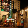
Last night, we saw the Hell’s Kitchen tour at the Pantages.
I’m not sure what to say, which is something different from being speechless. The show had remarkable dancing, and the story was somewhat like Keys’ biography. Well, a little. The music was beautiful, and the performances were very good. And yet, I was left unmoved.
As I noted, the story was somewhat like Keys’ own. It does take place in Manhattan Plaza in New York City’s Hell’s Kitchen community, where Keys did grow up. The lead character, Ali, was the child of a bi-racial family where the father left early, and she was raised by a single-mom who was a former actress. Her wikipedia bio notes that Keys “credits her “tough” mother for anchoring her on a right path as opposed to many people she knew who ended up on the wrong path and in jail. Keys attributed her unusual maturity as a young girl to her mother, who depended on her to be responsible while she worked…” But from there it diverges. Whereas Keys was raised on Jazz music, sang and started playing piano at the age of six, and started classical piano training at age seven, the lead character in Hell’s Kitchen took a different path. Ali wants to go out with the dangerous boys, including and especially Nuk, a pickle-drum drummer and house painter. She had no other interest in music until she goes to the music room at her apartment, where she meet Miss Liza Jane who starts teaching her piano. This is at age 16-17, and seemingly in a year or less she has it mastered. The story in the musical concerts Ali’s relationship with Nuk, how that impacts her relationship with her mother, and how she discovered music through Miss Liza Jane. It deals with Ali maturing into a more adult relationship with her mother and her mostly-absent father.
Talking about the story, I should explain the title of this writeup. One of the key plot lines in the story is about music, and how Ali’s discovery of the piano provides her a refuge from the turmoil and leads her to a path forward and out. The other key plot line of the story is the love of family: Although Ali fights with her mother Jersey, they ultimately work through it and grow to depend upon and support each other. Jersey provides the investment into Ali’s safety that moves her forward.
My wife really enjoyed the story. I found it interesting, but could see how it had been assembled to use the music catalog. It is hard to do an effective jukebox musical. There are lots of them, and we’re seeing perhaps the first and best example of them next week, Ain’t Misbehavin’ . Others are hit and miss. Some, like Jersey Boys, work well. Some, like Mamma Mia, are fluff that exists to highlight a great musical catalog. Here, the story was a reasonable one, but it would have been better if I had been able to understand the lyrics that were supposedly supporting the story. The problem was that the sound design for the tour left the side orchestra seats with muddy sound, and the fast nature of the lyrics made it hard to understand the words. This isn’t a problem for those familiar with an artists catalog before the show: they already know the songs and the words. Those who are unfamiliar with the artist are dependent on the sound designer to make the show legibly audible in all the seats. The tour missed its mark in that area (and I know it is the tour: we’ve had no other problems recently with sound design in the Pantages).
This brings us to the music. I’m torn on how to express this. The music was good, but it just wasn’t the style or musical genre that hooked me. I enjoyed it; I was tapping my foot throughout the faster songs. But it didn’t have the underlying melodic lines I tend to like; I can’t really say that the music would make me go out and buy albums from Alicia Keys catalog. This is unlike, say, American Idiot, which I enjoyed so much I started buying albums from Green Day. Listening to the music while writing this up, it has a very R&B feel to it. Slow R&B at times. But not being my style doesn’t make it bad; it just makes it not my style. My wife thoroughly enjoyed the music. I believe that if you like modern pop or R&B music and especially Alicia Keys, you’ll enjoy this music.
The dance was spectacular, but again: it was modern. I don’t know how to describe it. Hip-hop? Street? Break? All I know is that it wasn’t traditional theatre dancing and that it was really fun to watch. The dance performances were very strong. When compared to the last show we saw in Southern California, Brigadoon, the dancing was 180° different. Brigadoon was traditional and spoke the language of ballet and ballroom, with a little celtic thrown in. HK was street and angles and bounce and rapid angular movement. Each beautiful in their own way.
The performances were outstanding. Alas, we didn’t get to see the tour lead, Maya Drake, as Ali. Instead, we got Marley Soleil who normally plays Jessica. Soleil was spectacular as Ali, bringing a great energy and a wonderful voice to the role. But the actor who moved me the most was Roz White as Miss Liza Jane. She brought a gravitas to the role that shone from the stage, and was just a delight to watch. Also strong was Kennedy Caughell as Jersey, Ali’s mom. She had an incredibly strong duet in the second act that just blew everyone away. I also was blown away by the musical performances of the actors. I don’t mean singing—I mean playing instruments. I was closely watching those who were supposedly playing piano: Soleil as Ali, White as Liza Jane, Desmond Ellington as Davis. All seemed to be really playing the instruments, including the pedal work. The actors who were playing the pickle tub drums were also really playing. It is nice to see the talent on stage.
Will this show have a long life post-tour? That’s harder to say. There’s no confetti cannon, which is a plus. The music is accessible to the “youngers”, which will bring in the audience. But the scenic design depends heavily on projections to create the “New York” feel, and to establish locale. Will regional or smaller theatres be able to duplicate the staging? That’s really hard to say.
Speaking of New York: The closing song is “Empire State of Mind”, essentially a tribute to New York as the greatest city in the world. This hit very strange in Los Angeles. Theatre is so very centered in New York and in Broadway, that the writers often forget that theatre exists in other cities, and that other cities can also be great.
So, overall, what is my assessment of the show. It certainly wasn’t a bad show; that’s reserved for things like Girl from the North Country or I, Caligula. It wasn’t a favorite show: one that I might go out of my way to see multiple times, or feel compelled to see regional productions of. Well, maybe on the latter, just to see if a different take on the show uncovers something or works without the original staging.
As for the assessment. For those that know of and appreciate Keys’ music, this was a very good jukebox musical with a compelling story and remarkable performances. For those unfamiliar with Keys’ music: This is a good exposure to her music. You’ll really enjoy the performances and the dance and the compelling storyline.
Hell’s Kitchen continues at the Hollywood Pantages through June 21, 2026. Tickets are available through the Broadway in Hollywood/Pantages website.
Credits
Hell’s Kitchen. Music and lyrics by Alicia Keys. Book by Kristoffer Dias. Directed by Michael Greif. Choreography by Camille A. Brown.
Cast [underscores indicate “at our performance”; strikeouts indicate “not at our performance”; ↑ indicates “swung up”]: Maya Drake Marley Soleil Ali; Kennedy Caughell Jersey; Roz White Miss Liza Jane; Desmond Sean Ellington Davis; Jonavery Worrell Knuck; Rashada Dawan Crystal; ‘Zaiah Ellis Q, Ensemble; Mae-Lynn Flores Ensemble; Marques Furr Asten Stewart Dance Ensemble, “Hallelujah” Dancer, Ensemble; Destini Hendricks Dance Ensemble, “Unthinkable” Dancer, “Work on It” Dancer, Ensemble; Sean Holland II ‘Riq; Gigi Lewis Tiny, Ensemble; Christopher Miller Dance Ensemble, “Unthinkable” Dancer, Ensemble; Usman Ali Mughal Dance Ensemble, “Work on It” Dancer, Ensemble, Police Officer; Chikezie “Chike” Nwankwo Ray; Sangeetha “Sang” Santhebennur Dance Ensemble; Marley Soleil Sydney Townsend Jessica; Beda Spindola Millie, Ensemble; Ethan Zundell Dance Ensemble; Stemarciae Bain Ensemble; TeeTee Ensemble. Swings: ↑ Stemarciae Bain Asst. Dance Captain; Miya Bass; Jaylen T. Bryant; Sherée Marcelle Dunwell; Alfred Jackson Fight Captain; ↑ Asten Stewart; ↑ TeeTee, ↑ Sydney Townsend, Timothy Wilson Dance Captain.
Music Department ( indicates local): Adam Blackstone Music Supervisor, Co-Orchestrator, Co-Arranger; Tom Kitt Music Consultant, Co-Orchestrator; Lily Ling Assoc Music Supervisor; Kristy Norter Music Coordinator; Emily Orr Music Director, Keyboard 1; Enrico de Trizio Ableton and Electronic Drum Programmer; Joy Brown Asst. Conductor, Keyboard 2; Darrick Brown Music Assoc, Keyboard Swing; Azana Hightower Guitar 1; Jamick A. Johnson-Hector Bass; Adam Bailey Percussion; Brandon Brooks Drums; Dan Lutz Bass (5-String Electric, Acoustic Stick Bass, Synth Bass); Eric Heinly Music Contractor; Randy Cohen/Randy Cohen Keyboards LLC Synthesizer Programming; Chris Sutherland Drum Programming; Jared “Choclatt” Crawford Bucket Drum Consultant; Jason Berlanger Music Asst.; Emily Grishman Music Copying; Timothy Hanson Music Preparation.
Production and Creative: Alicia Keys Book Music, and Lyrics; Kristoffer Diaz Book; Michael Greif Director; Camille A. Brown Choreographer; Robert Brill Scenic Designer; Dede Ayite Costume Designer; Natasha Katz Lighting Designer; Gareth Owen Sound Designer; Peter Nigrini Projection Designer; Mia Neal Hair and Wig Designer; Michael Clifton Makeup Designer; Monet Assoc. Director; Rickey Tripp Assoc. Choreographer; Tom Schall Fight Director; Rocio Mendez Intimacy Coordinator; Bond Theatrical Tour Booking, Marketing, and Publicity; Doug Rodgers Company Manager; Veronica Aglow Production Stage Manager; Hollace Jeffords Stage Manager; Jasmin Holton Asst Stage Manager; Amber Dickerson Sub Asst Stage Manager; Caroline Inches Sub Asst Stage Manager; Kate Murray, CSA & Heidi Griffiths, CSA Casting; Juniper Street Productions Production Manager; Foresight Theatrical General Manager; Aaron Lustbader Executive Producer; The Public Theatre Originating Theatre.
Administrivia
I am not a professional critic. I’m a retired cybersecurity professional, a roadgeek who does a highway site and a podcast about California Highways, and someone who loves live performance. I buy all my own tickets, unless explicitly noted otherwise. I do these writeups to share my thoughts on shows with my friends and the community. I encourage you to go to your local theatres and support them (ideally, by purchasing full price tickets, if you can afford to do so). We currently subscribe or have memberships at: Center Theatre Group/Ahmanson Theatre; Broadway in Hollywood/Pantages Theatre; Pasadena Playhouse; The Soraya, Chromolume Theatre, and 5-Star Theatricals.
Want to find a show: Check out the Theatre Commons LA show list. Other good lists are the Theatre in LA listings; the TodayTix listings; OnStage 411 (use the “shows” drop down); and Theatermania.
As the Tonys approach, shows left and right have been announcing that they will be going on tour (even shows that are closing). So, even though we haven’t started the 2026-2027 seasons for Broadway in Hollywood (BIH) and the Center Theatre Group (CTG), here are my predictions for the 2027-2028 seasons in Los Angeles.
* indicates shows for which tours are not yet announce, but I’m guessing they will tour.
Sources: Playbill as indicated, Tours to You, Broadway League Tours.
| Show | Where It Will End Up |
| The Lost Boys | BIH/Pantages |
| Ragtime | BIH/Pantages |
| Every Brilliant Thing | CTG/Taper, but note there will be a local production at The Main in Sept. 2026 |
| Beaches | BIH/Pantages |
| Titanique | BIH/Pantages |
| Just In Time | BIH/Pantages |
| Two Strangers Carry A Cake Across New York | CTG/Ahmanson |
| Schmigadoon! | BIH/Pantages |
| Cats: The Jellicle Ball* | CTG/Taper, but poss. BIH/Pantages |
| Giant* | CTG/Ahmanson (but possibly as a local production) |
| Rocky Horror – New Broadway Production* | BIH/Pantages |
| Rodgers & Hammerstein’s Cinderella | BIH/Pantages (Add-On) |
| Heathers – The Musical | CTG/Ahmanson |
| Liberation* | In 2027 at the Geffen Playhouse |
| The Ballusters* | Local production at the Geffen or Pasadena Playhouse. |
Additionally, May saw the opening of ticket sales for the Hollywood Fringe Festival. There are over 2,150 performances over the month of June; there are 439 shows listed in the show catalog. These all occur during the month of June, with multiple shows throughout the day. 20 minutes to move in; then the show; 20 minutes to move out. Ticket prices are low. The shows run the gamut, from totally strange to one person shows to full on short plays to musical reviews. You’re sure to find something you’ll like.
Upcoming
Key:  Theatre /
  Music / ◊ Other Live Performance – Next 90ish Days (⊕ indicates ticketing is pending).
- June: Ain’t Misbehavin’ at Ebony Rep; Elegies at Chromolume; Primary Trust at CTG/Taper; Mamma Mia at CTG/Ahmanson.
- July: Mexodus at Pasadena Playhouse; The Wizard of Oz at 5-Star Theatricals; If/Then at Chromolume Theatre.
- August: Beauty and the Beast at BIH/Pantages;
- September: Water for Elephants at BIH/Pantages; ⊕ The Visit at Pasadena Playhouse; The Turning at Taper/CTG; ⊕ Sutton Foster at The Soraya; ⊕ Catch Me If You Can at The Colony Theatre; ⊕Every Brilliant Thing at The Main;
🎭 Music Saves, Family Invests | "Hells Kitchen" @ BIH/Pantages
May. 31st, 2026 07:31 pmAs of the time I’m writing this, I have 57,778 songs in my music library. However, until the musical Hell’s Kitchen popped onto the scene, I don’t think I had ever knowingly listened to a song by Alicia Keys. That’s actually not a surprise: Most of my music listening is music on my iPod Classic; I discover new music through the Tony Awards, the Woodsongs Radio Hour, the Irish and Celtic Music Podcast, and (until it stopped its podcast) the Mostly Folk podcast. I’m into folk and bluegrass and cast albums. Although I enjoy rhythm and I enjoy the blues, I’m not that much into the slower R&B music. I generally don’t watch the Grammys as I’m not really into modern hip-hop and rap, and so I don’t discover the new and upcoming artists unless they are on something else I watch. To put it succinctly, Keyes was new to me.
Shortly before the 2024 Tony awards, I downloaded the cast album of Hell’s Kitchen into my library and onto my iPod. It was interesting and had some good songs, although I couldn’t really discern the story. After all, this was a jukebox musical, where the songs are selected from an artists catalog to fit a story and set the mood, and they don’t always serve, advance, and illuminate the plot.
Last night, we saw the Hell’s Kitchen tour at the Pantages.
I’m not sure what to say, which is something different from being speechless. The show had remarkable dancing, and the story was somewhat like Keys’ biography. Well, a little. The music was beautiful, and the performances were very good. And yet, I was left unmoved.
As I noted, the story was somewhat like Keys’ own. It does take place in Manhattan Plaza in New York City’s Hell’s Kitchen community, where Keys did grow up. The lead character, Ali, was the child of a bi-racial family where the father left early, and she was raised by a single-mom who was a former actress. Her wikipedia bio notes that Keys “credits her “tough” mother for anchoring her on a right path as opposed to many people she knew who ended up on the wrong path and in jail. Keys attributed her unusual maturity as a young girl to her mother, who depended on her to be responsible while she worked…” But from there it diverges. Whereas Keys was raised on Jazz music, sang and started playing piano at the age of six, and started classical piano training at age seven, the lead character in Hell’s Kitchen took a different path. Ali wants to go out with the dangerous boys, including and especially Nuk, a pickle-drum drummer and house painter. She had no other interest in music until she goes to the music room at her apartment, where she meet Miss Liza Jane who starts teaching her piano. This is at age 16-17, and seemingly in a year or less she has it mastered. The story in the musical concerts Ali’s relationship with Nuk, how that impacts her relationship with her mother, and how she discovered music through Miss Liza Jane. It deals with Ali maturing into a more adult relationship with her mother and her mostly-absent father.
Talking about the story, I should explain the title of this writeup. One of the key plot lines in the story is about music, and how Ali’s discovery of the piano provides her a refuge from the turmoil and leads her to a path forward and out. The other key plot line of the story is the love of family: Although Ali fights with her mother Jersey, they ultimately work through it and grow to depend upon and support each other. Jersey provides the investment into Ali’s safety that moves her forward.
My wife really enjoyed the story. I found it interesting, but could see how it had been assembled to use the music catalog. It is hard to do an effective jukebox musical. There are lots of them, and we’re seeing perhaps the first and best example of them next week, Ain’t Misbehavin’ . Others are hit and miss. Some, like Jersey Boys, work well. Some, like Mamma Mia, are fluff that exists to highlight a great musical catalog. Here, the story was a reasonable one, but it would have been better if I had been able to understand the lyrics that were supposedly supporting the story. The problem was that the sound design for the tour left the side orchestra seats with muddy sound, and the fast nature of the lyrics made it hard to understand the words. This isn’t a problem for those familiar with an artists catalog before the show: they already know the songs and the words. Those who are unfamiliar with the artist are dependent on the sound designer to make the show legibly audible in all the seats. The tour missed its mark in that area (and I know it is the tour: we’ve had no other problems recently with sound design in the Pantages).
This brings us to the music. I’m torn on how to express this. The music was good, but it just wasn’t the style or musical genre that hooked me. I enjoyed it; I was tapping my foot throughout the faster songs. But it didn’t have the underlying melodic lines I tend to like; I can’t really say that the music would make me go out and buy albums from Alicia Keys catalog. This is unlike, say, American Idiot, which I enjoyed so much I started buying albums from Green Day. Listening to the music while writing this up, it has a very R&B feel to it. Slow R&B at times. But not being my style doesn’t make it bad; it just makes it not my style. My wife thoroughly enjoyed the music. I believe that if you like modern pop or R&B music and especially Alicia Keys, you’ll enjoy this music.
The dance was spectacular, but again: it was modern. I don’t know how to describe it. Hip-hop? Street? Break? All I know is that it wasn’t traditional theatre dancing and that it was really fun to watch. The dance performances were very strong. When compared to the last show we saw in Southern California, Brigadoon, the dancing was 180° different. Brigadoon was traditional and spoke the language of ballet and ballroom, with a little celtic thrown in. HK was street and angles and bounce and rapid angular movement. Each beautiful in their own way.
The performances were outstanding. Alas, we didn’t get to see the tour lead, Maya Drake, as Ali. Instead, we got Marley Soleil who normally plays Jessica. Soleil was spectacular as Ali, bringing a great energy and a wonderful voice to the role. But the actor who moved me the most was Roz White as Miss Liza Jane. She brought a gravitas to the role that shone from the stage, and was just a delight to watch. Also strong was Kennedy Caughell as Jersey, Ali’s mom. She had an incredibly strong duet in the second act that just blew everyone away. I also was blown away by the musical performances of the actors. I don’t mean singing—I mean playing instruments. I was closely watching those who were supposedly playing piano: Soleil as Ali, White as Liza Jane, Desmond Ellington as Davis. All seemed to be really playing the instruments, including the pedal work. The actors who were playing the pickle tub drums were also really playing. It is nice to see the talent on stage.
Will this show have a long life post-tour? That’s harder to say. There’s no confetti cannon, which is a plus. The music is accessible to the “youngers”, which will bring in the audience. But the scenic design depends heavily on projections to create the “New York” feel, and to establish locale. Will regional or smaller theatres be able to duplicate the staging? That’s really hard to say.
Speaking of New York: The closing song is “Empire State of Mind”, essentially a tribute to New York as the greatest city in the world. This hit very strange in Los Angeles. Theatre is so very centered in New York and in Broadway, that the writers often forget that theatre exists in other cities, and that other cities can also be great.
So, overall, what is my assessment of the show. It certainly wasn’t a bad show; that’s reserved for things like Girl from the North Country or I, Caligula. It wasn’t a favorite show: one that I might go out of my way to see multiple times, or feel compelled to see regional productions of. Well, maybe on the latter, just to see if a different take on the show uncovers something or works without the original staging.
As for the assessment. For those that know of and appreciate Keys’ music, this was a very good jukebox musical with a compelling story and remarkable performances. For those unfamiliar with Keys’ music: This is a good exposure to her music. You’ll really enjoy the performances and the dance and the compelling storyline.
Hell’s Kitchen continues at the Hollywood Pantages through June 21, 2026. Tickets are available through the Broadway in Hollywood/Pantages website.
Credits
Hell’s Kitchen. Music and lyrics by Alicia Keys. Book by Kristoffer Dias. Directed by Michael Greif. Choreography by Camille A. Brown.
Cast [underscores indicate “at our performance”; strikeouts indicate “not at our performance”; ↑ indicates “swung up”]: Maya Drake Marley Soleil Ali; Kennedy Caughell Jersey; Roz White Miss Liza Jane; Desmond Sean Ellington Davis; Jonavery Worrell Knuck; Rashada Dawan Crystal; ‘Zaiah Ellis Q, Ensemble; Mae-Lynn Flores Ensemble; Marques Furr Asten Stewart Dance Ensemble, “Hallelujah” Dancer, Ensemble; Destini Hendricks Dance Ensemble, “Unthinkable” Dancer, “Work on It” Dancer, Ensemble; Sean Holland II ‘Riq; Gigi Lewis Tiny, Ensemble; Christopher Miller Dance Ensemble, “Unthinkable” Dancer, Ensemble; Usman Ali Mughal Dance Ensemble, “Work on It” Dancer, Ensemble, Police Officer; Chikezie “Chike” Nwankwo Ray; Sangeetha “Sang” Santhebennur Dance Ensemble; Marley Soleil Sydney Townsend Jessica; Beda Spindola Millie, Ensemble; Ethan Zundell Dance Ensemble; Stemarciae Bain Ensemble; TeeTee Ensemble. Swings: ↑ Stemarciae Bain Asst. Dance Captain; Miya Bass; Jaylen T. Bryant; Sherée Marcelle Dunwell; Alfred Jackson Fight Captain; ↑ Asten Stewart; ↑ TeeTee, ↑ Sydney Townsend, Timothy Wilson Dance Captain.
Music Department ( indicates local): Adam Blackstone Music Supervisor, Co-Orchestrator, Co-Arranger; Tom Kitt Music Consultant, Co-Orchestrator; Lily Ling Assoc Music Supervisor; Kristy Norter Music Coordinator; Emily Orr Music Director, Keyboard 1; Enrico de Trizio Ableton and Electronic Drum Programmer; Joy Brown Asst. Conductor, Keyboard 2; Darrick Brown Music Assoc, Keyboard Swing; Azana Hightower Guitar 1; Jamick A. Johnson-Hector Bass; Adam Bailey Percussion; Brandon Brooks Drums; Dan Lutz Bass (5-String Electric, Acoustic Stick Bass, Synth Bass); Eric Heinly Music Contractor; Randy Cohen/Randy Cohen Keyboards LLC Synthesizer Programming; Chris Sutherland Drum Programming; Jared “Choclatt” Crawford Bucket Drum Consultant; Jason Berlanger Music Asst.; Emily Grishman Music Copying; Timothy Hanson Music Preparation.
Production and Creative: Alicia Keys Book Music, and Lyrics; Kristoffer Diaz Book; Michael Greif Director; Camille A. Brown Choreographer; Robert Brill Scenic Designer; Dede Ayite Costume Designer; Natasha Katz Lighting Designer; Gareth Owen Sound Designer; Peter Nigrini Projection Designer; Mia Neal Hair and Wig Designer; Michael Clifton Makeup Designer; Monet Assoc. Director; Rickey Tripp Assoc. Choreographer; Tom Schall Fight Director; Rocio Mendez Intimacy Coordinator; Bond Theatrical Tour Booking, Marketing, and Publicity; Doug Rodgers Company Manager; Veronica Aglow Production Stage Manager; Hollace Jeffords Stage Manager; Jasmin Holton Asst Stage Manager; Amber Dickerson Sub Asst Stage Manager; Caroline Inches Sub Asst Stage Manager; Kate Murray, CSA & Heidi Griffiths, CSA Casting; Juniper Street Productions Production Manager; Foresight Theatrical General Manager; Aaron Lustbader Executive Producer; The Public Theatre Originating Theatre.
Administrivia
I am not a professional critic. I’m a retired cybersecurity professional, a roadgeek who does a highway site and a podcast about California Highways, and someone who loves live performance. I buy all my own tickets, unless explicitly noted otherwise. I do these writeups to share my thoughts on shows with my friends and the community. I encourage you to go to your local theatres and support them (ideally, by purchasing full price tickets, if you can afford to do so). We currently subscribe or have memberships at: Center Theatre Group/Ahmanson Theatre; Broadway in Hollywood/Pantages Theatre; Pasadena Playhouse; The Soraya, Chromolume Theatre, and 5-Star Theatricals.
Want to find a show: Check out the Theatre Commons LA show list. Other good lists are the Theatre in LA listings; the TodayTix listings; OnStage 411 (use the “shows” drop down); and Theatermania.
As the Tonys approach, shows left and right have been announcing that they will be going on tour (even shows that are closing). So, even though we haven’t started the 2026-2027 seasons for Broadway in Hollywood (BIH) and the Center Theatre Group (CTG), here are my predictions for the 2027-2028 seasons in Los Angeles.
* indicates shows for which tours are not yet announce, but I’m guessing they will tour.
Sources: Playbill as indicated, Tours to You, Broadway League Tours.
| Show | Where It Will End Up |
| The Lost Boys | BIH/Pantages |
| Ragtime | BIH/Pantages |
| Every Brilliant Thing | CTG/Taper, but note there will be a local production at The Main in Sept. 2026 |
| Beaches | BIH/Pantages |
| Titanique | BIH/Pantages |
| Just In Time | BIH/Pantages |
| Two Strangers Carry A Cake Across New York | CTG/Ahmanson |
| Schmigadoon! | BIH/Pantages |
| Cats: The Jellicle Ball* | CTG/Taper, but poss. BIH/Pantages |
| Giant* | CTG/Ahmanson (but possibly as a local production) |
| Rocky Horror – New Broadway Production* | BIH/Pantages |
| Rodgers & Hammerstein’s Cinderella | BIH/Pantages (Add-On) |
| Heathers – The Musical | CTG/Ahmanson |
| Liberation* | In 2027 at the Geffen Playhouse |
| The Ballusters* | Local production at the Geffen or Pasadena Playhouse. |
Additionally, May saw the opening of ticket sales for the Hollywood Fringe Festival. There are over 2,150 performances over the month of June; there are 439 shows listed in the show catalog. These all occur during the month of June, with multiple shows throughout the day. 20 minutes to move in; then the show; 20 minutes to move out. Ticket prices are low. The shows run the gamut, from totally strange to one person shows to full on short plays to musical reviews. You’re sure to find something you’ll like.
Upcoming
Key: ♦ Theatre / ♣ Music / ◊ Other Live Performance – Next 90ish Days (⊕ indicates ticketing is pending).
- June: ♦ Ain’t Misbehavin’ at Ebony Rep; ♦ Elegies at Chromolume; ♦ Primary Trust at CTG/Taper; ♦ Mamma Mia at CTG/Ahmanson.
- July: ♦ Mexodus at Pasadena Playhouse; ♦ The Wizard of Oz at 5-Star Theatricals; ♦ If/Then at Chromolume Theatre.
- August: ♦ Beauty and the Beast at BIH/Pantages;
- September: ♦ Water for Elephants at BIH/Pantages; ♦⊕ The Visit at Pasadena Playhouse; ♦ The Turning at Taper/CTG; ♣⊕ Sutton Foster at The Soraya; ♦⊕ Catch Me If You Can at The Colony Theatre; ♦⊕Every Brilliant Thing at The Main;
 This entry was originally posted on Observations Along the Road as 🎭 Music Saves, Family Invests | "Hells Kitchen" @ BIH/Pantages by cahwyguy. Although you can comment on DW, please make comments on original post at the Wordpress blog using the link to the left. You can sign in with your LJ, DW, FB, or a myriad of other accounts. Note: Subsequent changes made to the post on the blog are not propagated by the SNAP Crossposter; please visit the original post to see the latest version. P.S.: If you see share buttons above, note that they do not work outside of the Wordpress blog.
Banking functionality I would like
May. 31st, 2026 03:33 pmIntermittently I would like to bring forward a single instance of a regular payment.
Normally transfer money from A to B on the 17th, but this month you want to do it 2 days early? Tough, you have to make the early payment, wait for the later payment to go through, and then get it transferred back.
Life with two kids: bus chat
May. 31st, 2026 11:06 amChildren are having a very loud conversation with each other on the bus about where babies come from.
I'm hiding three rows back.
I finished ANOTHER thing!
May. 30th, 2026 09:49 amI finally finished Upon A Star, by PigeonCoop Designs, from the book Cross Stitch In The Forest. It took me a little over a year; I work on many projects at once, so this is pretty fast for me. The confetti stitches were SUCH a pain! I used a sharp embroidery needle so I could weave the tails through the weave of the Aida fabric.


Interesting Links for 30-05-2026
May. 30th, 2026 12:00 pm- 1. Clinicians raise concerns over gender-affirming healthcare evidence reviews in open letter to NHS England
- (tags:UK bigotry healthcare LGBT transgender )
- 2. There are dozens of trees planted across America whose seeds went to the moon
- (tags:moon nature trees viaDanielDWilliam )
- 3. Please Use AI
- (tags:ai life poetry )
- 4. Opposing the EHRC guidance - UNISON needs your voice
- (tags:unions LGBT transgender UK )
- 5. Oscar-winning 'Star Wars' editor Marcia Lucas dies at 80
- (tags:StarWars obituary )
- 6. High Density Living, 2000 Years Ago: Inside the Roman Apartment Building
- (tags:history housing rome )
outstanding customer service
May. 29th, 2026 04:19 pmA couple months ago, one of the other players in the D&D campaign we play in ordered a custom 3D-printed miniature for his character. The campaign has been going for a while and is a lot of fun (and not super-lethal), and this seemed like a cool idea. So I designed and ordered a mini for my character too.
Hero Forge has tools that support a huge range of character races, equipment, poses, and lots more. My character is a monk and one of their standard poses has a kick, so I started with that. I was tickled to discover that, among the many hand-held objects in their catalogue, they have a staff with a flower on one end -- perfect for my sylvan character who does in fact have a Staff of Flowers. She uses a mix of the staff and unarmed strikes in combat, so I put the staff in one hand so the other hand can punch. I ended up with this:

The mini came a few weeks ago and looked great. Alas, at the first game, the top of that staff broke off. Another player attempted a repair, which turned out to be hard.
I wrote to Hero Forge. I said I was new to 3D printing and described what happened. I said I wasn't asking for a remake; the figure had arrived intact and this was obviously my design error. My question was: for the future, do they have or would they consider adding tools that help with evaluating a design for weak spots? Had I realized how risky the staff was, I might have omitted it. (One of the players looked at the break and said something like "yeah, given how they had to have printed this, that doesn't surprise me" -- but I've never done anything with 3D printing before so I didn't have those instincts.)
They wrote back and said this was not the experience they wanted their customers to have, they would remake the figure for me, and before they do, would I like to adjust anything? This blew me away -- I wouldn't have been too surprised if they'd offered a remake at a reduced price or charged me shipping or something, but nope -- they offered me a complete do-over at no charge. I adjusted the position of the staff to give it anchor points at both ends:

The lower petal and both curves of the staff now touch the hair, and the bottom is still anchored at the base of the figure. I had to do a lot of experimenting with shoulder, elbow, and wrist angles and bends to get there, but it worked.
(In case you're wondering: I changed the flower color so that, at scale, it would look less like part of the clothing now that it was close to "hat" position.)
The replacement came today and it looks great! I will happily order from them the next time I need a custom mini.